Showing posts with label gps. Show all posts

Saturday, 26 December 2009

Boxing Day

On Boxing Day we decided to walk towards the Ponte bar at Barril da Alva along the track behind the house. It was a lovely mild sunny day. We had uploaded aerial images onto the gps that would help make a decision as to which tracks to take, as we knew we would come to forks in the trackway. As it was the first time we had used the Garmin Bing Map tool we were eager to try it out.

We walked for about a mile and tried to keep as close to the river as the track would allow. We came across a lovely picnic site and river beach area beside the river, that we had no idea was there before.


A little further on and we arrived at the Ponte Bar on the outskirts of the village. And then we turned back, retracing our steps. Along the way we had wonderful views of the mountains and the river. There was a section where the slate showed distinct fossilisation of leaves.


The walk to the Ponte and back was just over 4 miles. We intend to extend the walk by heading down the lanes through Digueifel, through Vila da Cova, down to the Ponte, then along the track back to the house.

The accuracy of the images on the gps were excellent, and this will be a boon for us to explore more on foot etc without paper maps.

Back at home it was time for a snack and a cuppa. We had traditional Portugese cakes called Broas de Natal that were made in Seia. They are a bit like a scone and contain mixed fruit and nuts. On the ingredients there is batata-doce that is, apparently, sweet potato. Overall they are dry and a bit disappointing on the taste scale.

Friday, 20 November 2009

Caminho do Xisto da Benfeita - Way of the Shale of the Benfeita

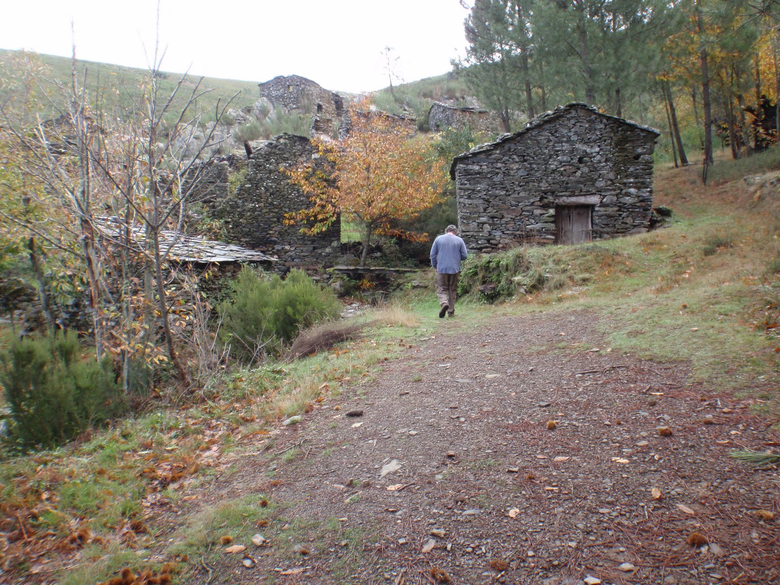
Friday was a perfect day for a walk. Not too hot (forecast max 14 degrees celsius) no rain, and clear. We set off from Benfeita, walked uphill for about 3 miles to a small mountain village called Sardal, and then it was mostly downhill past Fraga da Pena (waterfalls and picnic area) through Pardieros (another small mountain village) - stopping for a coffee at a local bar - and then the final leg down through a valley back to Benfeita. The walk is one of the aldeias walks, and is quite well signposted, though a few times we couldn't see the markers and plumped for what we hoped was the right way. Fortunately we were right most of the time. We did have the gpx track provided and used that to confirm our passage using our new gps. We had also calibrated in Google Earth the basic map of this walk (NB: at the time of writing the map is only obtainable at the start of the walk itself - we'd been through Benfeita a few times and took a photo of the map board). One of the real problems we have been having is there are no detailed maps apart from military maps - the price of the maps is not cheap). There are plenty of walks, it seems, but you seem to have to pay for a guide to take you out to know where most of them are. The walk we did yesterday would have cost us 25 euros each, and that didn't include lunch or travelling to the starting point.


The walk is about 10km in total, and takes you through current and abandoned agricultural landscape, past ruined schist villages, countless waterfalls, and woodland. At a leisurely pace, stopping for taking photos and having a snack, it took us about 5 hours. Apart from when we stopped for a coffee, the only people we saw were two Portugese villagers harvesting olives.

It felt such a privilege to be able to wander this area freely. It was like stepping into a secret garden on a mega scale. Almost every turn had another nook, cranny, wonderful view, gushing stream or waterfall. The floor was strewn with many different varieties of mushrooms, fallen chestnuts, walnuts, and fruit. Sometimes the path was vivid red with the fallen medronho berries from the Strawberry Tree.

3 December 2009 - Additional Note: This site has a little more information about the Benfeita walk and some information about Piodao.

Thursday, 19 November 2009

Colcurinho

Yesterday we set off to do a geocache multi-cache with our new gps unit. With a new unit there are a few things you need to do, first of all it has travelled from the UK so it needs to find where it is, and then Jon had to calibrate the compass by holding the unit level, and turn round slowly in the same direction twice. No, it's not 1 April. It worked.

The multi-cache started at an amazing ruined schist village called Colcurinho. We explored the village and found the clues to the next stage. At the side of the village we noticed a footpath sign (noted to explore on another day).


Part two of the multi took us to a really pretty village called Santuário de Nossa Senhora das Preces. To enter the village you drive through gates, which feels a bit like you are trespassing. It sort of reminded us of Portmeirion, only you didn't pay to go in. We had a really lovely cup of coffee (cafe meio leite) at the cafe kiosk in the main square, 55 cents a cup. We found our cache clue which would take us to our final destination, but before we set off we visited the Botanical Garden.

The third and final part of the cache took us up, up, up and up to the top of Monte Colcurinho. On the top of the mountain is a chapel called Capela da Nossa Senhora das Necessidade. This place also has toilets, and a bar area. It was all locked up but we gather they have festas up here. The panoramic views were fantastic.

The gps performed very well, though we want to try and conserve the power a bit more to use less batteries. There are other things we want to try out with the gps, uploading existing gpx tracks for walks, and uploading the maps we aligned in Google Earth to see how accurate they are.

Today we are off to Arganil (Thursday is market day) to visit the tourist information centre mainly. We want to try and find information about the Centro Interpretativo de Chãs d´Égua, Arganil (Arte Rupestre near Piodao). We found out, when we were trying to find the walks near Colcurinho, that there are ancient cart tracks and spirals and the centre at Chas de Egua is dedicated to these.

Wednesday, 18 November 2009

Parcels

We have received various parcels this week. For parcels too large to fit into our post box at the top of the track, the postman leaves a card telling us to go to the post office at Galizes to collect it. Galizes is about a 10 minute drive away. Jon showed his passport as proof of identification. Very straightforward.

A parcel arrived from Barry and Lorraine, who had kindly gathered together about a dozen films for us to watch. We don't have a DVD player but they play fine on the laptop, and we have some speakers plugged in as well and it works a treat. Cuddling up on the sofa to watch a film is something of an event for us and feels special.

Another parcel arrived from Viv and Michael, with a Christmas card and wrapped presents. The card has been opened but the presents will be saved for Christmas morning.

We had our main Christmas present (to each other) early, and it arrived yesterday by Fedex. The chap from Fedex spoke only Portugese, and he was asking for Jon to sign for the package. But Jon was in the bath. So I said "banho" and did an impression of Jon scrubbing himself off in the bath. I think the chappie knew what I meant as he let me sign for the package and beat a rather hasty retreat.

Our present to each other this year is a new GPS. We broke the old Garmin Legend the other day, and though Jon rigged the pocket computer/satnav to act as a handheld GPS, it just wasn't the same sitting in the palm of your hand. Our Garmin Legend owed us nothing and, because we used it so much, we decided to treat ourselves to a new model. Our new GPS is a Garmin Oregon 300 and, by all accounts, it's fab.

Mapping (to Ordinance Survey standards) is something we are having a problem with over here. Jon recently discovered that with our new GPS we should be able to upload maps to it that we have calibrated in Google Earth. It's all very experimental at the moment, but if it works it will be a boon.

This morning there is a mist hanging over the valley, but it's early at the moment (0800) so hopefully the sun will burn that off by mid morning. Yesterday was warm and sunny, but the previous two days were wet but mild.

We also experienced our second thunderstorm. It came over us so fast we barely had time to unplug everything, including the telephone, when there was an enormous clap of thunder right overhead and the electricity went off.

This time we were armed with torches. Twig was inside safe and sound, though obviously terrified. Jon sorted the electrics, it was just a trip of the switches. After that the storm moved off very quickly, thank goodness.

Wednesday, 4 November 2009

Walk "Pardieros" Serra do Acor

Yesterday the weather forecast for Arganil was 0% precipitation, overcast, max 15 degrees, and that meant to us that it would probably be a great day for walking. Up until now it's been too hot for us!

However, the valley we were walking through was in the Serra do Acor and had its own microclimate, so it did rain, for a short while (as Peter Kay would say, it was that fine rain that really wets you).

But what a lovely walk it was. The paths were probably formed by the agricultural workers who used to live up in the valley in the schist cottages that are now mostly ruins. And more recently, Arganil council has done remedial work, building slate stairways etc, to enhance the route.

The walk was medium/difficult rating and this was because of a steep stretch about half way along. Without proper maps we did manage to stray off the route because of some confusion with the signage, and after about 15 minutes we turned back. Our detour though took us along another track that is part of the Aldeias do xisto trails, and from the little we saw it merits further investigation and seems well signposted.

Overall the walk was approximately 4.5 km and taking off 30 mins for going the wrong way, took us a leisurely 2 hours (incl photos and nosing about).


There are another 3 walks in the vicinity, with Mata da Margaraça being the place to get a leaflet for information (walks of different levels of difficulty and length). We hope, in time, to link the different walks together so we have a longer day out. We tracked the walk using our gps and hopefully will be able to upload the route for future reference.